SEVEN KEYHOLES
Although many people would like to name it a slot canyon, Seven Keyholes really isn’t one. In geologic terms, this straight and narrow canyon is a joint, or a fracture, which divides two large rock masses.
Joints are created when forces cause them to crack and separate. The rock is Aztec sandstone, as it is called locally in Nevada, or Navajo sandstone, as it is referred to in Utah, and throughout the Colorado Plateau.
Joints are usually straight, clean (non-jagged) breaks, with other joints forming and running parallel with each other.
What makes Seven Keyholes unique from other large joints found in sandstone is the hollowed-out bottom section of the canyon. It looks similar to Zion’s famous subway canyon, which is not a joint. But what caused this hollowed out portion?
In Zion, there was obviously a lot of constant rushing water and flash flood events. But was there that much rushing water at Seven Keyholes?
Probably not. Side canyons or joints branching off the main canyon of Seven Keyholes also have the hollowed-out bottom, further supporting the idea that it was not created by water.
Halfway on the hike between the trailhead to the entrance to Seven Keyholes, Native American petroglyphs can be found on the right. In Gold Butte National Monument, petroglyphs can be found all over, especially in the redish-orange Aztec (Navajo) sandstone.
Directions from Aravada Springs
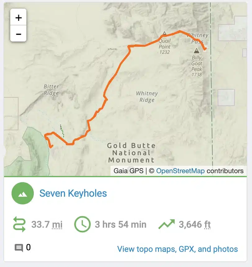
Seven Keyholes Slot Canyon is 19.8 miles, or 1 hour and 29 minutes from Aravada Springs. To get there, you head northwest on Pakoon Springs Rd toward Whitney Pass Rd for 0.4 miles. Continue onto Whitney Pass Rd for 5.1 miles. Then take a sharp left onto Gold Butte Rd for 7.2 miles. Turn right onto Mud Wash Rd and go another 2.5 miles. Then turn right to stay on Mud Wash Rd for another 1.7 miles. Continue straight for 1.9 miles. Then turn left toward Narrows N Rd and go another 0.1 miles. Turn left onto Narrows N Rd and go 0.1 miles. Continue onto Gold Butte Wash Rd for 0.8 miles.
GPS location 36°25'51.66"N 114°13'17.15"W

