LITTLE FINLAND
Bright flaming orange sandstone fins and outlandish shaped hoodoos leap from the desert floor. This place is amazing!
Not to be confused with the country of Finland, Little Finland is the unofficial name because of the rock formations that look like fins of fish and aquatic life. The official name is Hobgoblin's Playground. These stunning complex and intricate forms cover an area 2,000 feet by 400 feet. You can find it about 18 miles west of Aravada Springs.
This site is similar to other renowned Southwest locations of photogenic eroded rocks. For example, they have similar colors to Goblin Valley, and the same kind of weather patterns as Fantasy Canyon. But this place is more unusual than either of those two. This is on account of the complexity and variation of the rock forms, the relatively large area that they cover, and the scenic surroundings; the plateau is backed by taller, more conventionally eroded cliffs to one side, while to the other, the land slopes down towards Lake Mead. This allows for long distance views over many square miles of roadless desert, interrupted by some taller hills and other colorful sandstone Outcrops.
Many of the formations are very fragile - thin spurs extending several feet from their base, tiny arches, narrow fins - and doubtless some have already been damaged since the region was first publicized around 20 years ago.
But Little Finland is likely to remain relatively little visited owing to its remote location: the place is 37 miles from a major highway, on roads which decline from paved and fairly smooth. Then there are partially paved roads and bumpy, unpaved roads, but relatively good, unpaved and very stony roads. Finally, there are the last few miles where the surface is even rougher (in some places) and the drive requires a 4WD vehicle. A busy day might see half a dozen visitors, but most of the time there are no people here.
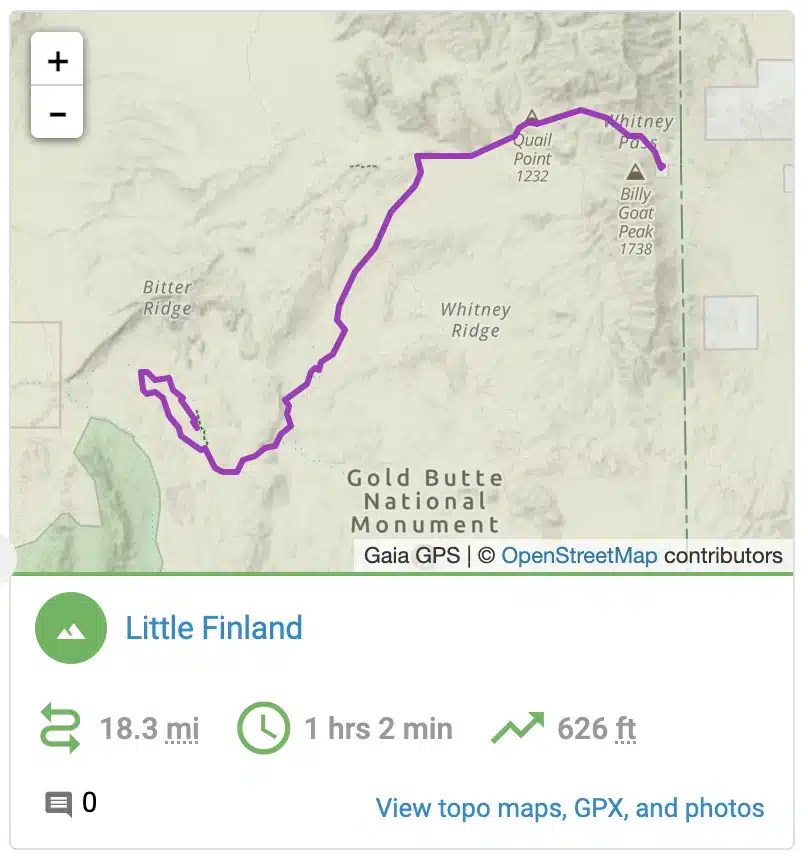
For the majority of visitors who do not have 4WD vehicles, Little Finland can be reached by cross-country hiking, starting 12 miles back along the approach road, which ahead takes a rather circuitous route. So, the walking distance is shorter. The minimum distance is 3.5 miles. However, there are several other resting areas close by, such as short slot canyons, petroglyphs, eroded rocks in many contrasting colors (unlike Little Finland where the sandstone is only red or orange).
A round trip of 10 miles allows some of these sites to be visited en route. If driving all the way, the track ends close to the base of the plateau. So, the only hiking needed is the short climb to the top. The formations themselves can all be seen in an hour or so, while walking another mile.
There is no charge to visit, nor to camp anywhere in this region; all of this area is publicly owned BLM land, and nearby Whitney Pocket is a popular place to stay, even for quite large RVs. Off-road vehicle use has increased in recent years, and has added to the visitation to Little Finland, though very few people explore by hiking cross country.

